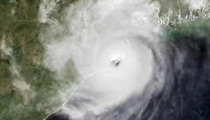
The deep depression over the Southwest Bay of Bengal is set to escalate into a cyclonic storm, named Cyclone Fengal, within the next 12 hours, according to the latest meteorological reports.
This developing weather system was pinpointed at 5.30 am on Wednesday morning as moving north-northwestwards at a pace of 13 kmph. The system at the time was positioned approximately 130 km east-southeast of Trincomalee in northwest Srilanka, 400 km southeast of Nagappattinam, 510 km southeast of Puducherry, and 590 km south-southeast of Chennai in Tamil Nadu.
EFFECTS ON DAILY LIFE
The system, tracked continuously by meteorological authorities, raised alarms for heavy rainfall, strong winds, and rough sea conditions in the region. The cyclonic storm is predicted to bring strong winds, heavy rainfall, and high sea waves along Tamil Nadu’s coastal districts, including Nagapattinam, Puducherry, Cuddalore, and Chennai.
Coastal Andhra Pradesh could also experience the storm’s peripheral effects.
The weather system will bring thunderstorm and lightning with moderate to heavy rain at isolated places in Tamil Nadu districts districts of Thiruvallur, Chennai, Chengalpattu, Kanchipuram, Villupuram, Cuddalore, Mayiladuthurai, Nagapattinam, Tiruvarur, Thanjavur, Pudukottai, Ariyalur, Perambalur, Sivagangai and Ramanathapuram, and Puducherry & Karaikal area.
There could be waterlogging in some areas, affecting the traffic and daily life movement.
Light to moderate rain accompanied by thunderstorms and lightning at isolated places in Nilgiris, Coimbatore, Kallakurichi, Thiruchirapalli, Tenkasi, Virudhunagar, Madurai, Thoothukkudi, Thirunelveli and Kanyakumari districts of Tamilnadu
HOLIDAY FOR SCHOOLS
Keeping in mind the cyclonic storm, the IMD issued a red alert for Mayiladuthurai, Nagapattinam, Thiruvarur and Karaikkal (Puducherry) districts till November 27.
Due to the heavy rain, Wednesday was declared a holiday for schools and colleges in districts of Chennai, Chengalpattu, Trichy, Ramanathapuram, Nagapattinam, Cuddalore, Villupuram, Thiruvarur, Thanjavur and Thiruvallur, Mayiladuthurai, Puducherry and Karaikkal.
Holiday was declared for just schools in Kancheepuram district.
BUILDING CYCLONIC SYSTEM
The disturbance, first observed as a deep depression on Tuesday afternoon, with wind speeds of 55-65 kmph. Over the past 24 hours, it intensified into a cyclonic storm with higher wind speeds of up to 85 kmph.
As of November 27, the storm continued its north-northwest trajectory towards the Tamil Nadu coast, skirting Sri Lanka along the way. Weather forecasters expect further intensification, with maximum sustained wind speeds reaching up to 85 kmph as it nears land. According to the India Meteorological Department (IMD), the system is expected to maintain its cyclonic storm and make landfall along Tamil Nadu’s southeastern coast sometime on Friday, November 29.
WARNINGS FOR COASTAL AREAS
The IMD warned that the storm will lead to “very rough sea conditions” in the Bay of Bengal, with waves reaching dangerous heights. Fishermen have been advised to avoid venturing into the sea until the system weakens.
Residents in Tamil Nadu and Puducherry have been urged to prepare for flooding, particularly in low-lying areas. Local authorities are on high alert, with disaster response teams ready to evacuate vulnerable regions. Public transportation and essential services may be disrupted as the storm closes in.
Authorities have also warned of potential damage to kutcha houses, crops, and communication lines due to strong winds.
METEOROLOGICAL INSIGHTS
The cyclone’s central pressure indicated a moderate-intensity storm. Satellite imagery showed heavy cloud cover organised around the storm’s core, with temperatures in the cloud tops dropping to -80°C to -93°C: a sign of strong convective activity.
This is the first significant cyclonic event for the Tamil Nadu coast this season. It follows typical patterns for cyclones in the Bay of Bengal, which often form in late November and track north-northwestward.
PREPARATIONS UNDERWAY
Disaster management authorities in Tamil Nadu and Puducherry are coordinating with the IMD to monitor the cyclone’s progress. Shelters are being prepared to accommodate evacuees, and essential supplies are being stocked in affected areas. Fishermen and coastal workers have been asked to remain ashore until the weather clears after November 29.
Tamil Nadu Chief Minister MK Stalin met with senior ministers and government officials on November 26 to review the state’s preparedness. District collectors from the Cauvery delta districts were also present. The cyclone is expected to weaken gradually after landfall, but its residual impact of heavy rains and flooding could persist for 48 hours.
Continuous updates will be issued by the IMD as the system moves closer to the coast.

